


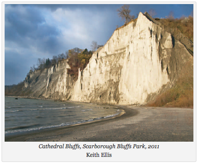
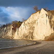
Recently, the primary focus of Toronto’s waterfront development has been on the transformation taking place in the downtown harbour and its oft perceived errant cousin to the west, Humber Bay. Few recognize that another transformation of no less magnitude is about to begin on the eastern shore in the Scarborough Bluffs, where the land rises 250 feet over the water’s edge. The Toronto and Region Conservation Authority (TRCA) is currently planning a major overhaul of about 11 kilometres of the Scarborough waterfront, from Bluffer’s Park in the west to East Point Park, near the mouth of Highland Creek. Make no mistake about it — this is a very big decision that has the potential to fundamentally alter the contour and shape of the eastern waterfront, and the way we relate to the lake, for generations to come. For example, north/south access points to the lake at Bluffer’s Park, the Doris McCarthy Trail (historic Gates Gully), Guild Park and Gardens and East Point will eventually be developed so that many more people, city wide, will be able to get down to the water. Let me say at the outset that I’m all for increasing access to the lake – it is our greatest public asset. That said, waterfront development is always a balancing act. As I said in Along the Shore, “The irony is that bringing people down to the water also brings destruction. In conservation there is loss, and in development there is always change.” I don’t think any of us really understands the enormity of the change that is potentially coming.
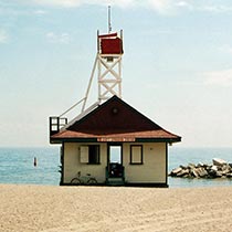
One of my main concerns is that what little beach and Bluffs area we still have left stands to be “gobbled up” in the desire to allow cyclists (and others) the ability to move along the entire length of the waterfront, unimpeded. Specifically, check out the TRCA’s disastrous “Headland-Beach” alternative at the east end of Bluffer’s Park (alternatives begin on page 18 — scroll down from there as the shoreline is divided into three segments and the alternatives move from east to west): http://www.trca.on.ca/dotAsset/217960.pdf. If this alternative is ultimately adopted, at least one third of Bluffer’s beach (many would say our best beach, city-wide) would be re-worked into a hardened armour rock and cobble structure at the water’s edge. The reason for such disruptive change? Apparently to facilitate a linkage to a newly minted section of the Waterfront Trail, which begins under Meadowcliffe Drive, a relatively short distance to the east.
In fairness, the TRCA has offered less intrusive alternatives for linking Bluffer’s beach to the Waterfront Trail at Meadowcliffe, including an expanded beach with boardwalk (contained in the document above). It continues to do wonderful work, preserving our ecological and natural heritage, city wide. I’ll be reviewing all the alternatives over the next few days. I urge you to do the same and to send in your comments, either by email or letter, to Lindsay Clapp, Project Manager, waterfront@trca.on.ca (101 Exchange Avenue, Vaughan, ON, L4K 5R6). You may also respond in the comments section of the workbook document noted in the paragraph below. My view is that our natural and cultural heritage should not be unduly compromised for the sake of increased access to Lake Ontario – any option that unnecessarily destroys the remaining Bluff faces over time, severely limits unobstructed views of the water and/or compromises the remarkably varied wildlife that inhabits the shore is simply unacceptable.
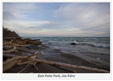
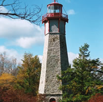
Incidentally, has anyone ever been to East Point Park, farther to the east? East Point is, geologically speaking, the eastern termination point of the Scarborough Bluffs. It is also our last remaining natural beach in the city, and it is a beauty. Can anyone honestly say with a straight face that destroying the natural beach and lining the shore with armour rock actually deepens our connection to the lake and the natural world? Ask yourselves folks: Would a similar action ever be contemplated at Toronto Island, where many of the natural beaches are constantly eroding? (See: http://trca.on.ca/the-living-city/green-infrastructure-projects/environmental-assessment-projects/gibraltar-point-erosion-control-project.dot.) The Waterfront Trail and a series of other connected trails already exist near the edge of the Bluffs. The solution to accessibility in this area is clear – leave the cyclists to their own devices at the top of the embankment. They’ll survive just fine. I’m asking you to send in your thoughts on Scarborough shoreline development to the TRCA asap, as the deadline is February 11, 2016. Here is the link to the workbook, where you can also leave your comments (if you don’t opt to send a letter): http://www.trca.on.ca/dotAsset/217818.pdf.
Please also remember: Toronto’s waterfront is for everyone, regardless of where we happen to live in the city. To friends in the west, south and north of our great city: please feel more than free to send in your comments to the TRCA.
Scarborough’s beaches fall into three different Wards. It would be great if you could also make your views known to the Councillors. Just forward all of them the comments you have made to the TRCA at the addresses below.
Here is their contact information:
Gary Crawford
Bluffer’s Beach
councillor_crawford@toronto.ca
Paul Ainslie
Grey Abbey Beach (may be viewed as an adjunct of East Point Beach)
councillor_ainslie@toronto.ca
Ron Moeser
East Point Beach
councillor_moeser@toronto.ca
As always,
Jane
janefairburn.com
{ 2 comments… read them below or add one }
Well put as always Jane. Any intrusion will hamper the delicate beauty. If people wish to visit the waterfront here, then by all means come down and enjoy today, as thousands of us have been doing all our lives
Thanks very much Steve.